P·16 · Electrical
Autonomous Drone Search and Tracking for Campus Lockdowns
A drone system that maps a campus, sweeps it on an autonomous search route, and follows a person, flown in a restricted, school-approved test area.
At a glance
- ~9%gap between predicted and actual detection times for placed markers
- Secondsto find a staged subject on the autonomous search route
- 1stSkillsUSA Drone Engineering, national (two-time state champion)
- Where
- SkillsUSA Drone Engineering, national champion
- Role
- Mission designer and pilot
- Status
- Complete
- Drone photogrammetry (Skyebrowse)
- Litchi waypoint missions
- Litchi Track Mode
- DJI drones
- Mission planning
- Airspace checks (B4UFly, Airmap)
- FAA Part 107
The problem
After living through a real lockdown on campus, I wanted a drone system that could support school safety without putting staff or students at risk. I set four goals:
- Map the campus in 2D and 3D for emergency-response planning.
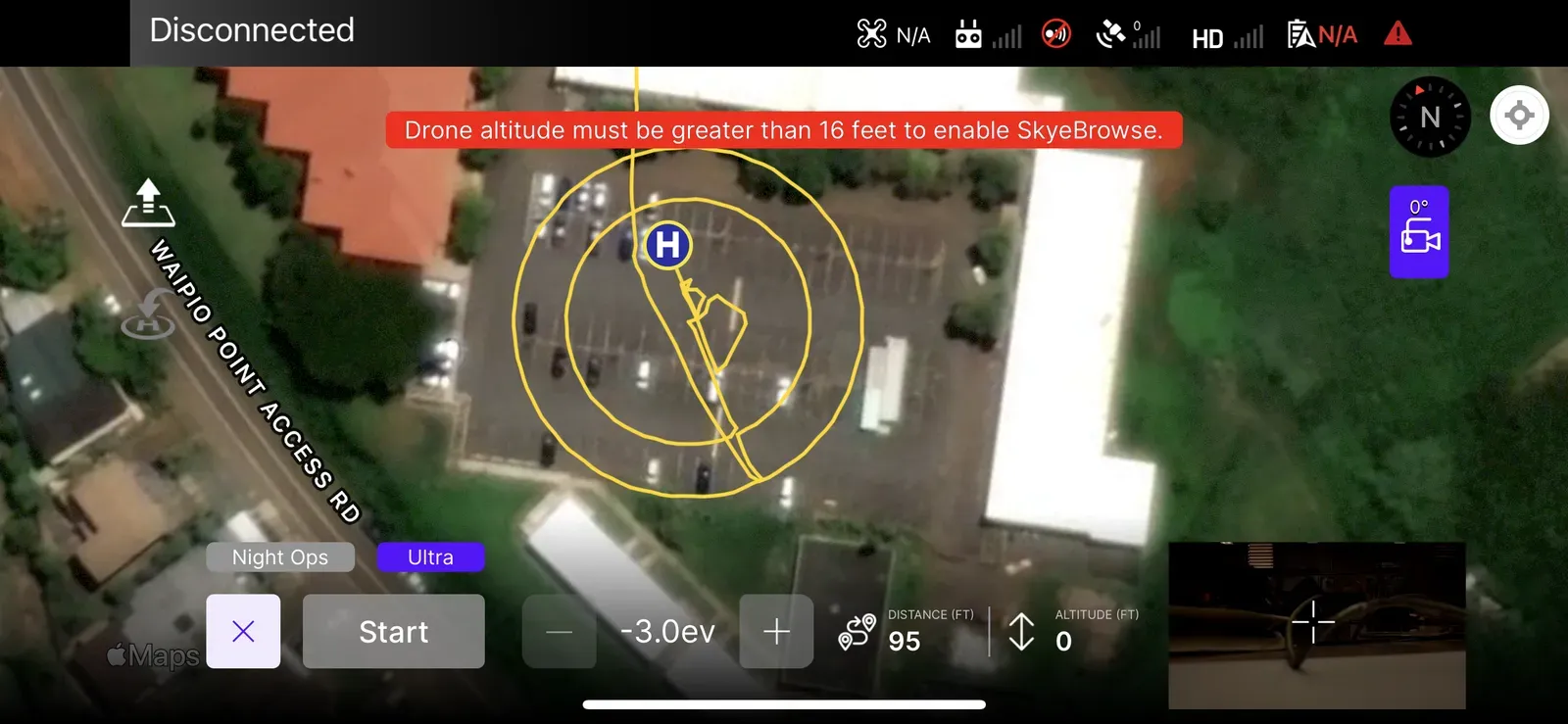
- Search large outdoor areas on an autonomous waypoint route.
- Track a moving person from a safe distance.
- Share live video with authorities (future work).
FAA rules restrict flying over people who are not participating, so every mission flew in a restricted, school-approved test area.
Approach
Flight preparation
Before every flight I verified Class G airspace with B4UFly and Airmap, checked conditions with UAV Forecast, and ran pre-flight checks on the gimbal, controller link, camera feed and battery. Before each search run I also rechecked weather, NOTAMs, GPS accuracy and magnetic interference. I logged every flight.
Mapping
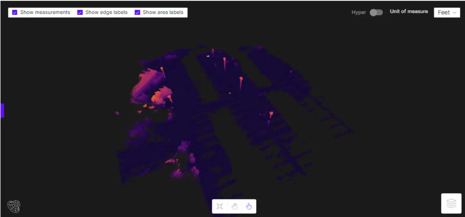
I mapped the test area with a DJI drone and Skyebrowse photogrammetry, flying a structured pattern of overlapping images and processing them into 3D models and 2D orthographic layouts. I checked the model against measurements taken in the parking lot.
Autonomous search
To simulate a lockdown where authorities need fast visual information, I planned a full-coverage route of the test zone with Litchi waypoints.
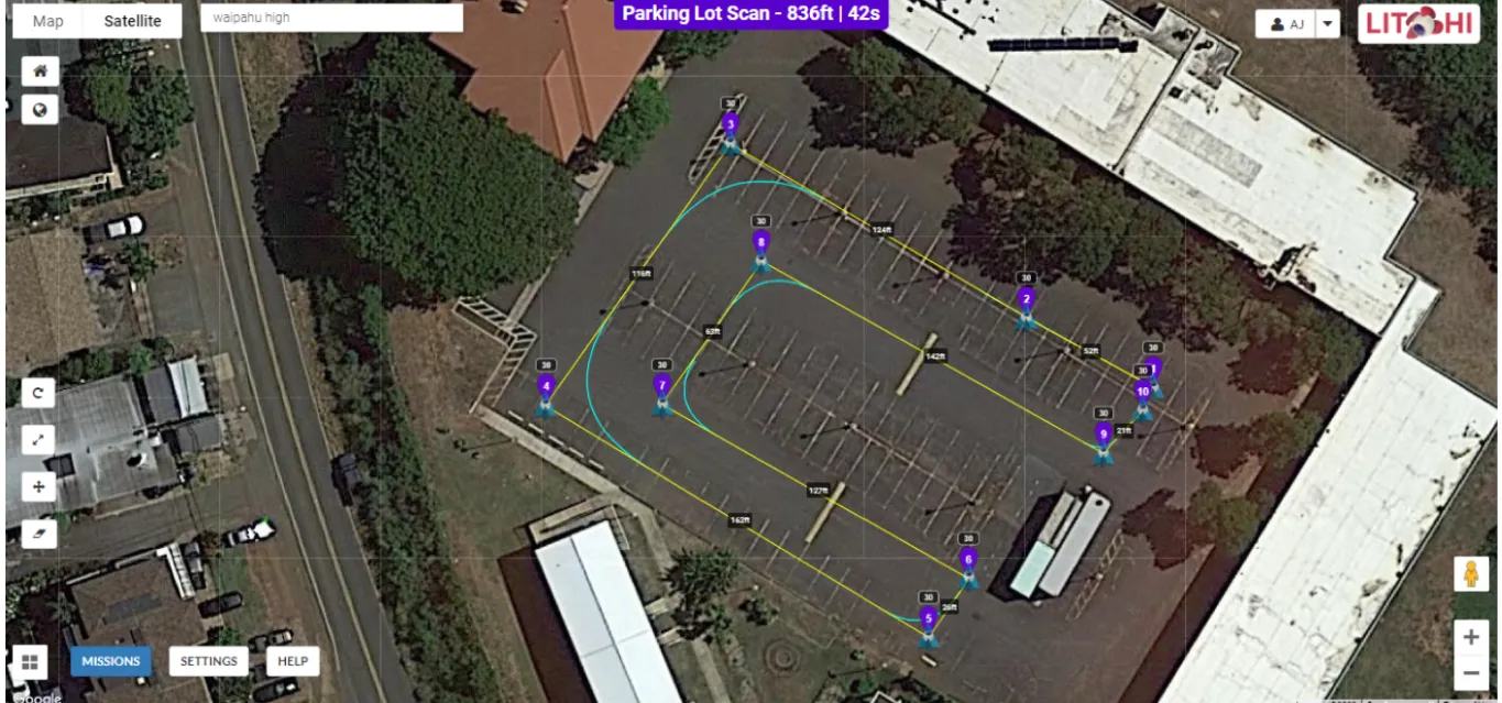
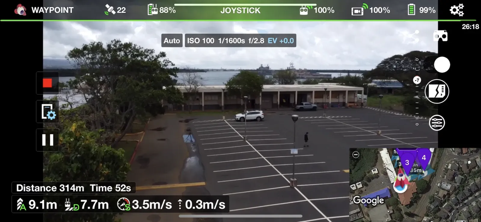
To test object detection, I placed markers around the area to stand in for dropped items such as a weapon. From the drone’s speed and the route geometry, I calculated when each marker should come into view, then compared that with when it actually did.
Tracking
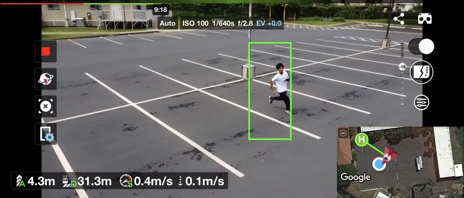
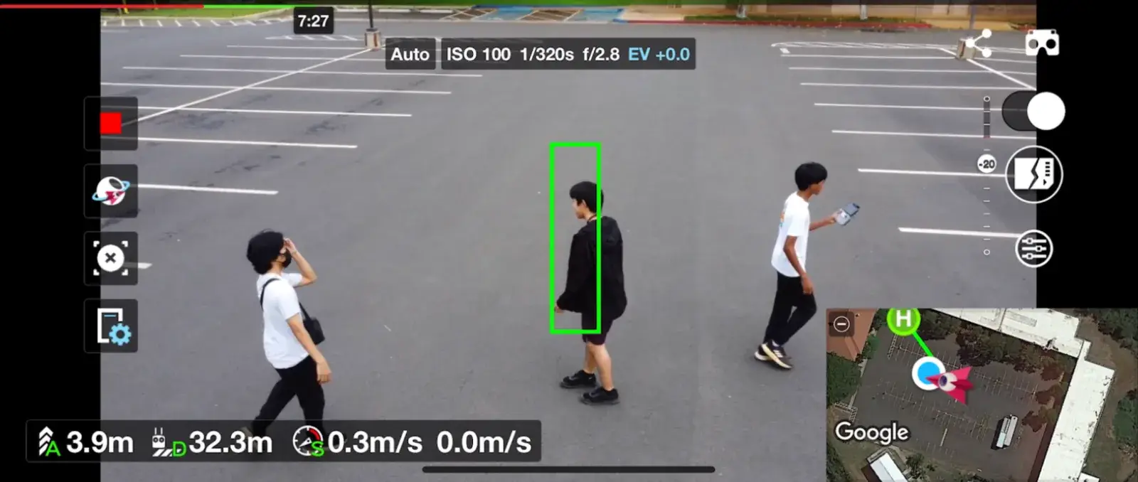
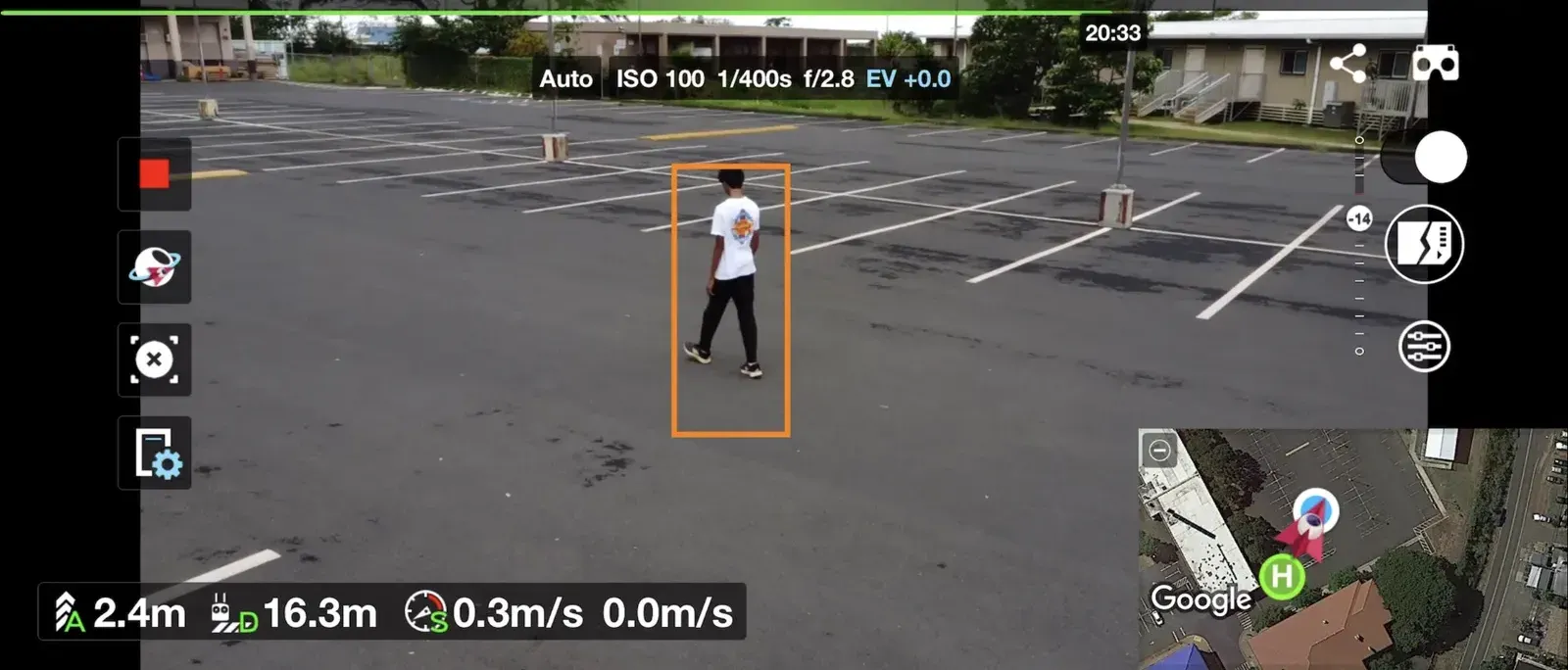
I tested Litchi’s Track Mode with walking and running trials, random turns and changing distances.
Results
- Search: the drone found a staged subject within seconds.
- Detection timing: actual detection times landed within about 9% of my predictions.
- Tracking: reliable at moderate speeds.
What failed
- A crash on the first search run. Litchi has no obstacle avoidance. I analyzed the crash, raised the altitude margins, adjusted the waypoints, and re-ran the mission safely.
- Map warping. Dark asphalt reflects little light, which warped parts of the 3D model.
- Lost lock. Strong wind and sudden motion occasionally broke the track.
- Target switching. When several people passed in front of the tracking box, the drone sometimes switched to the wrong person (the situation in the photo at the top of the page).
- Blind spots. Occluded objects, overhangs and indoor areas can’t be detected from the air.
Next steps: higher-accuracy photogrammetry, obstacle avoidance on autonomous missions, steadier tracking through crowds, and a live stream for authorities.
Recognition
The project won the SkillsUSA Drone Engineering national championship, after two state titles. About 380,000 students compete in SkillsUSA across 115 contests. I presented the project to the Hawaii military.
My contribution
I planned and flew the missions, built the maps, designed the search route and detection test, and ran the tracking trials. The tracking itself uses Litchi’s built-in Track Mode.
Gallery
2 images